 N 39°09,371´ E 23° 11,378´
<<-- Click for Google maps!
N 39°09,371´ E 23° 11,378´
<<-- Click for Google maps!Petraki
N 39°09,371´ E 23° 11,378´
<<-- Click for Google maps!
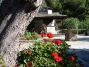
Petraki
Map of the area
Back to Front Page
Greece
 Here
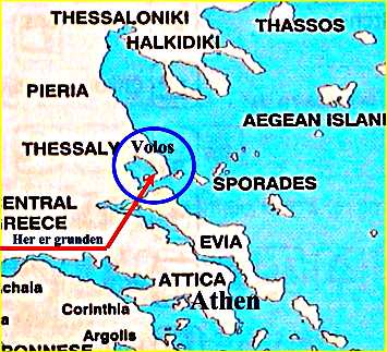
is a part of Greece. At the bottom is Athens and on top Thessaloniki.
Approximately halfway between the two cities is Volos, the 4th. biggest city in
Greece. From here the peninsula of Pilion radiates, and to the right of
Pilion are the Sporades with the islands of Skiathos, Skopelos and Alonnisos.
Here
is a part of Greece. At the bottom is Athens and on top Thessaloniki.
Approximately halfway between the two cities is Volos, the 4th. biggest city in
Greece. From here the peninsula of Pilion radiates, and to the right of
Pilion are the Sporades with the islands of Skiathos, Skopelos and Alonnisos.
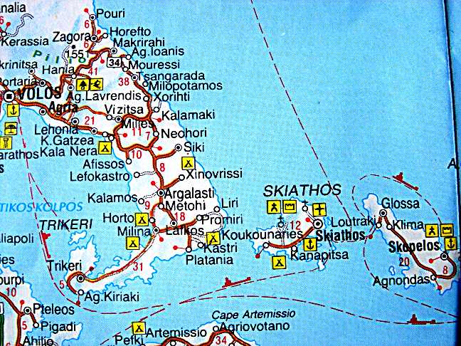
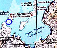
Below you can see the peninsula of Pilion with the city of Volos right at the edge of the map. In Pilion we are on our own ground. It takes about 75 minutes to go from Petraki to Volos by car, where you can get most of the things, you need. You can of course also go to Volos by boat. In the earlier days this was the only possibility. We know quite a lot about the southern part of Pilion, and Petraki is approximately under the sign for camping by the village of Milina. We often go to Milina. It takes about 20 minutes with "Skidtfisken", but only 8 minutes with the speed-boat.
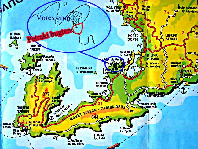
Now we are closer. Milina is in the middle on your right hand. The blue circle shows magnified two small islands going north. The bay of Petraki is marked with a red line. There are some houses along the bay.. Our plot is hatched, and is not quite as big as you can see on the picture. The plot is 18000 m2 big and full of olives and low vegetation. On one side (towards the Petraki bay) there is a sandy beach, and there you will find our two houses. Unfortunately our plot does not go all the way to the opposite bay (Apostoli), but we often go over there swimming, as it is wonderfully sunny in the afternoon. There are flat cliffs all the way down to the edge of the sea.
 Our
plot is here marked with a blue circle. The Petraki bay is well sheltered, as
you can see from this map, and our boat is swinging here.The bay is just big
enough to make it possible. As you can see, there is no road in the peninsula.
The northern point of the peninsula is called Kefalo, which means head in Greek.
Our
plot is here marked with a blue circle. The Petraki bay is well sheltered, as
you can see from this map, and our boat is swinging here.The bay is just big
enough to make it possible. As you can see, there is no road in the peninsula.
The northern point of the peninsula is called Kefalo, which means head in Greek.
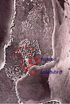
When we were to buy the plot, a man came from the Department of Forestry in order to see, how much of the plot was actually buildable. Only cultivated land can be build on. And cultivated land in these parts means olive groves. He then went around with a worn-out briefcase and looked at the vegetation. I was allowed to take a photo of one of his pictures.They were aerial photographies taken at different times.The Greek are of course very inventive as to make their olives reproduce in order to make their plots bigger. The forces of law and order therefore use aerial photographies.
The outline of our plot is marked with red.
At the bottom of the picture you can see the bay. The dotted areas are olives. The rest is forest=maki.
Back to Front Page